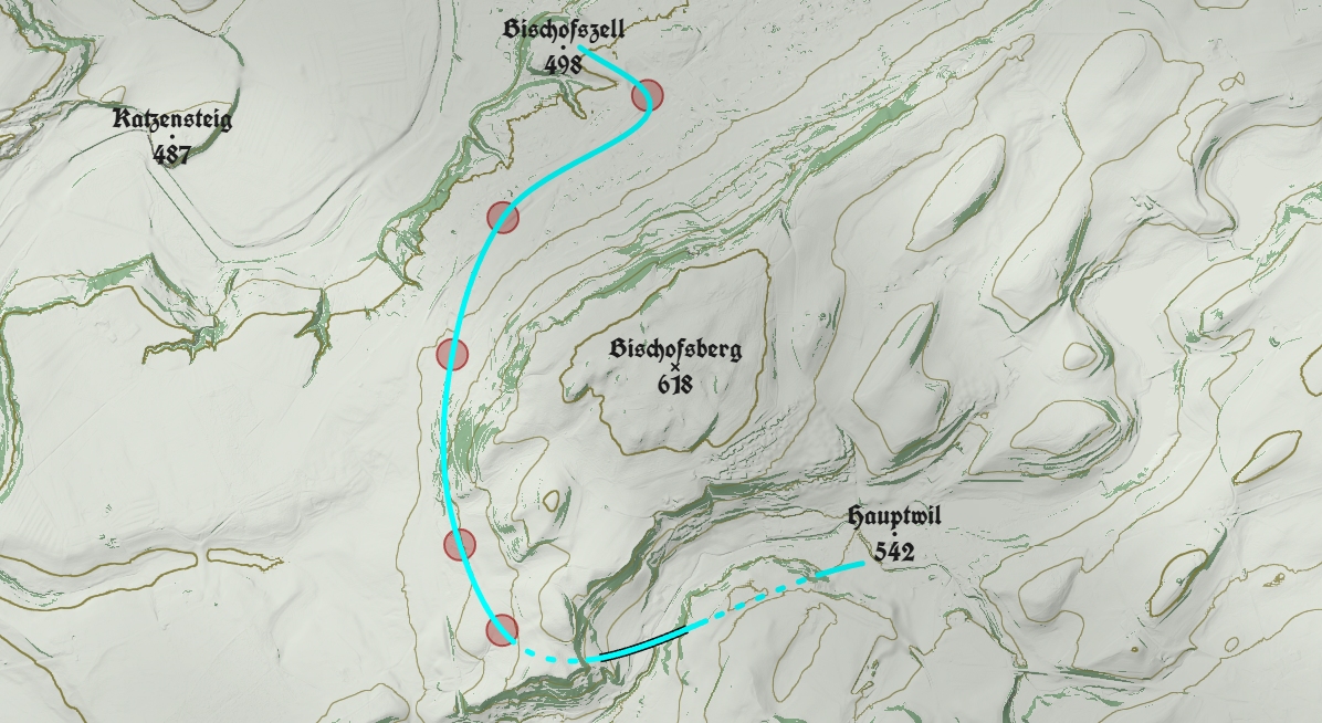
If there’s no foxer on Friday, blame Alpine Route. Right now, Roman, my Chief Foxer Setter, should be putting together a vowel-stripped list of ‘33 Things Wot You Might Find in Russia’ but instead he’s pondering possible routes for a mule track in the Swiss Alps.
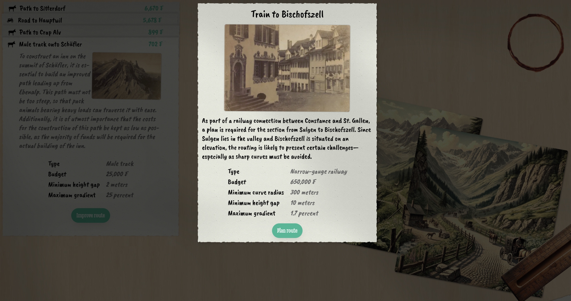
I’m unsure whether to classify this free curio as a puzzle game or a sim. Construction costs, the severity of gradients, the sharpness of corners… the factors you must bear in mind when route-planning a new mountain path, track, road or railway, are rooted in reality and a number of the game’s challenges are inspired by real 19th Century civil engineering projects, but thanks to Dirk Plate’s admirably minimal approach, you don’t need to be Switzerland’s answer to Thomas Telford to make progress in the campaign.
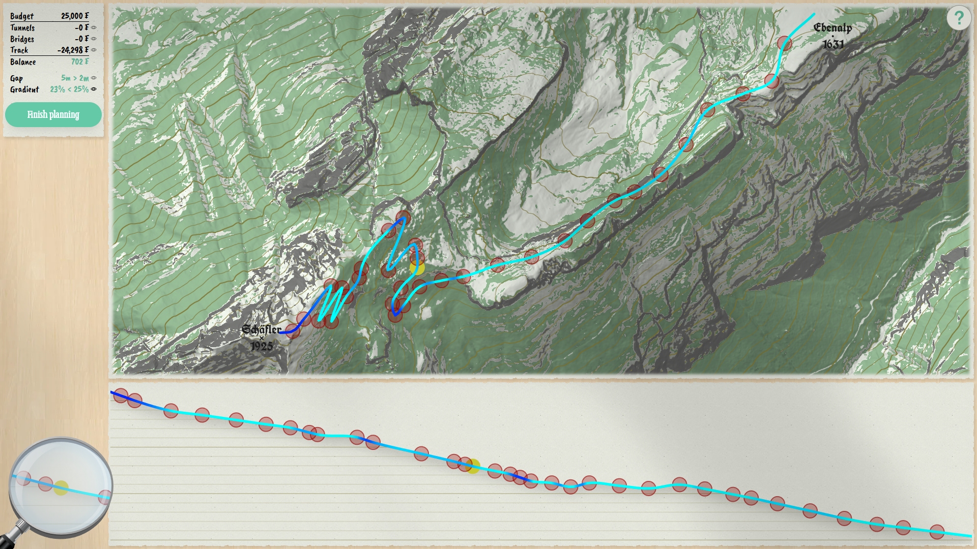
Simply add nodes to the arrow-straight route line that appears at the start of every mission, then thoughtfully reposition said nodes in such a way that the line turns blue for its entire length (line colour indicates gradient), and sheds enough dashed and outlined sections (tunnels and bridges) to satisfy the project accountant, and the thought-provoking commissions will keep coming.
Maybe when there’s a Saxon + Bohemian Switzerland expansion pack.
https://en.wikipedia.org/wiki/Bastei
This has reminded me of a school trip where there was a museum with almost this exact program on it on a BBC B. You had to plot a railway over/through a hill and try and do it as cheaply as possible.
A geography teacher tried setting us a similar problem.
We all got a photocopied sheet with a map on it, all made up of square grids. The cost to the railway company was a constant per square. The sizes of the squares changed to represent various terrains: hills, marshland, whatever.
Since it wasn’t specified, I got round it by plotting a route through the most corners where four squares met.