
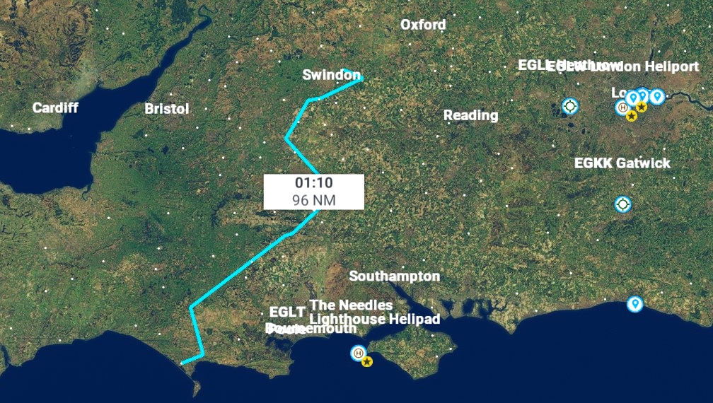
Stretching from The Wash to Portland Bill, England’s sash of grass-topped chalk is emblazoned with dozens of huge hillside geoglyphs. Accompany me on the very first FS2020-based Tally-Ho Corner air tour – a hundred-mile jaunt from Oxfordshire to the Dorset coast – and you’ll get splendid aerial views of many of these literal landmarks.
Apologies for the four-year take-off delay, ladies and gentleman! Roman and myself are latecomers to FS2020 and even though we finally gained the hardware necessary to run FSX’s successor before Christmas, it’s taken us a while to overcome our initial reservations and trepidation, and get accustomed to the new interface. Will my colleague ever completely forgive Asobo for not including mouse yoke support? Probably not, but since discovering this third-party gizmo, his rants have become less frequent and expletive-littered.
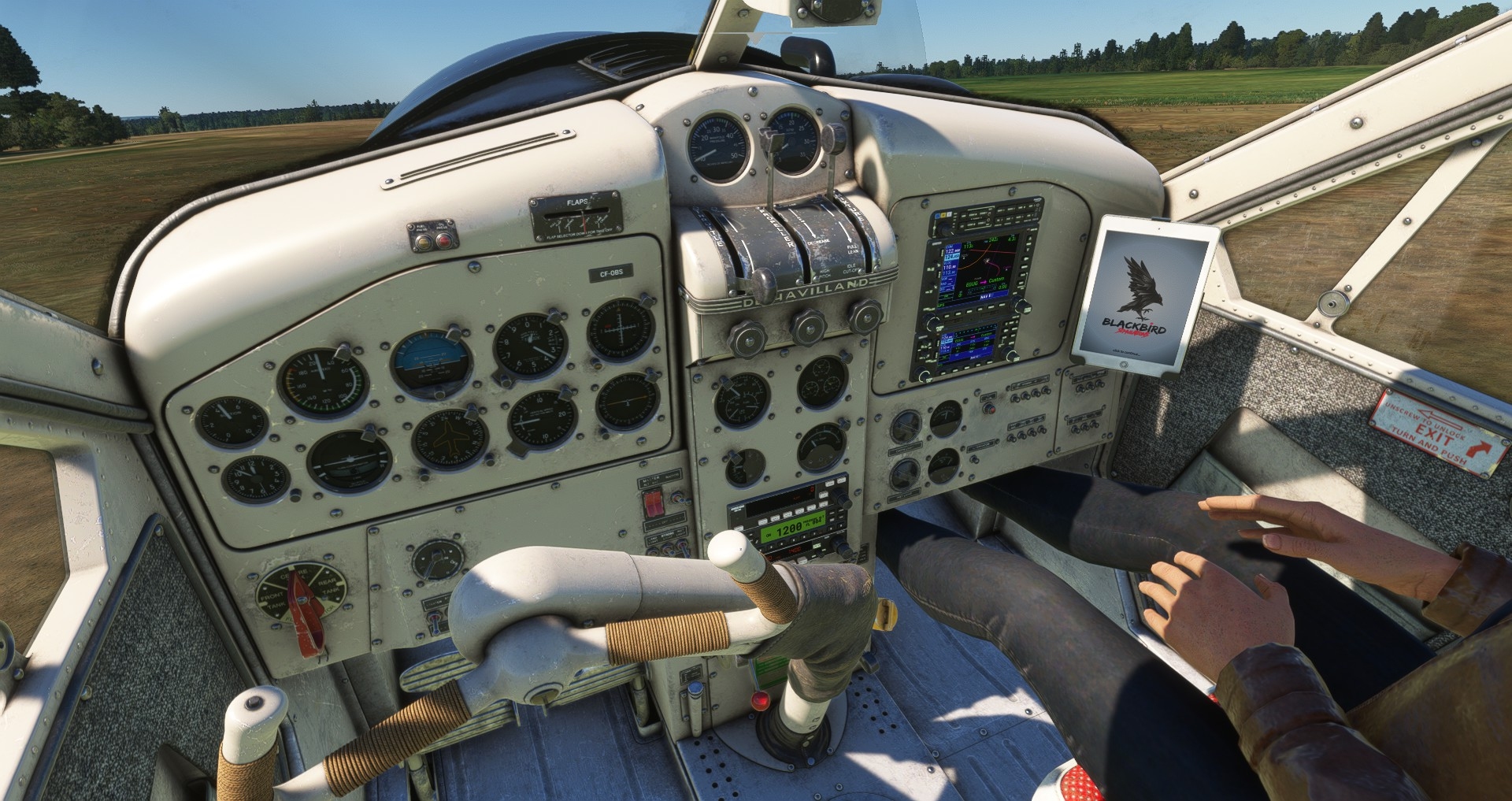
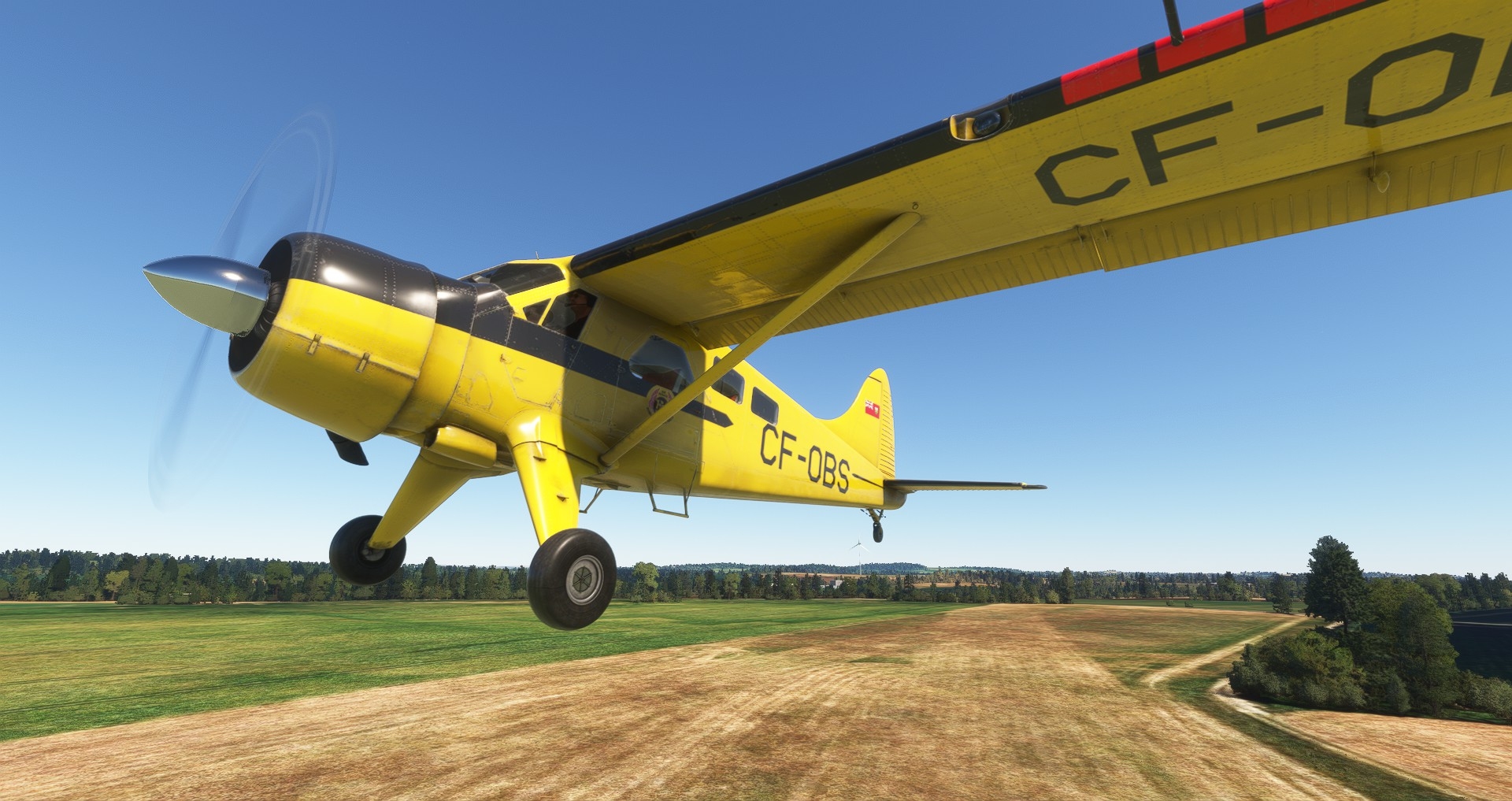
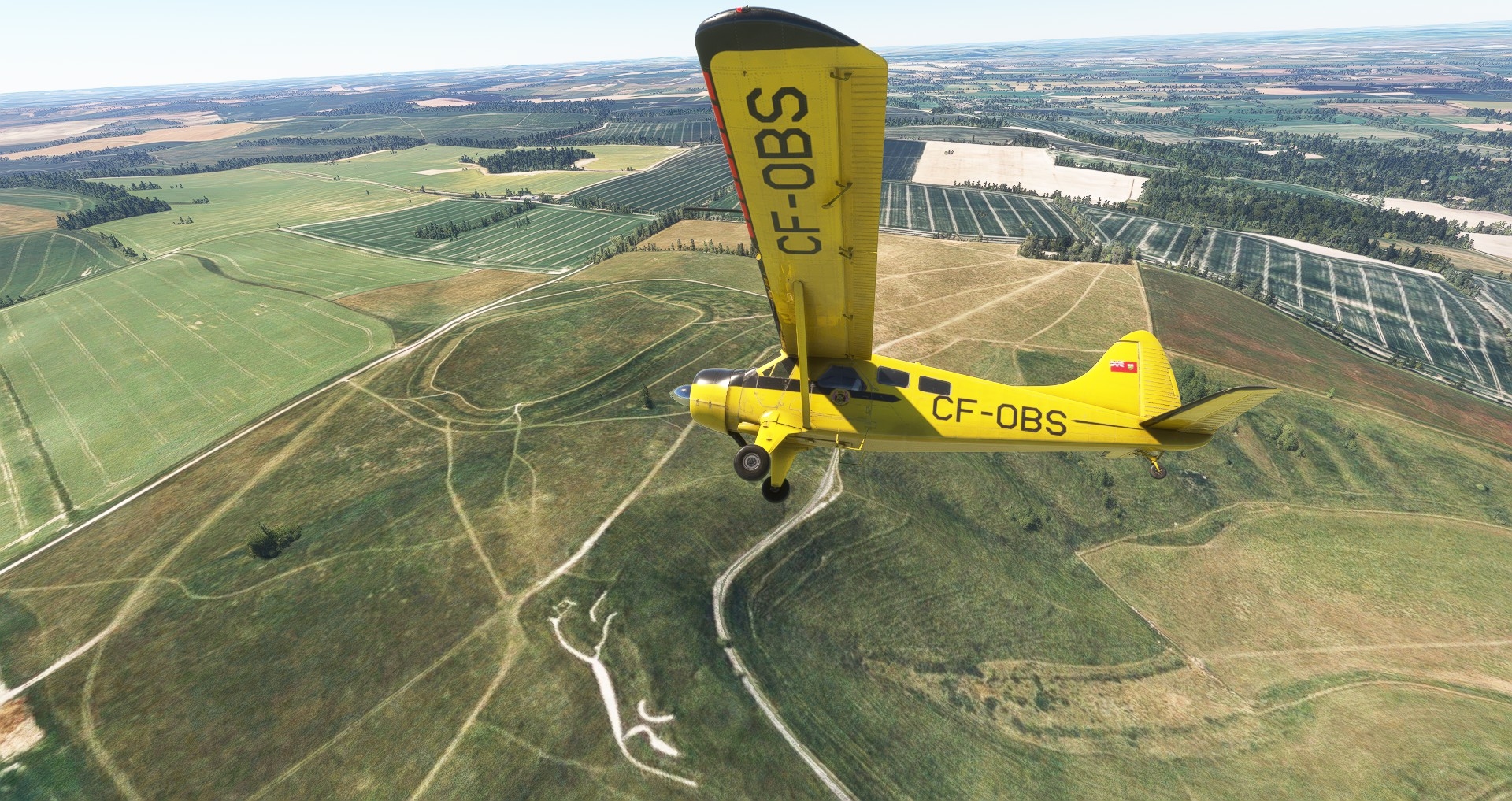
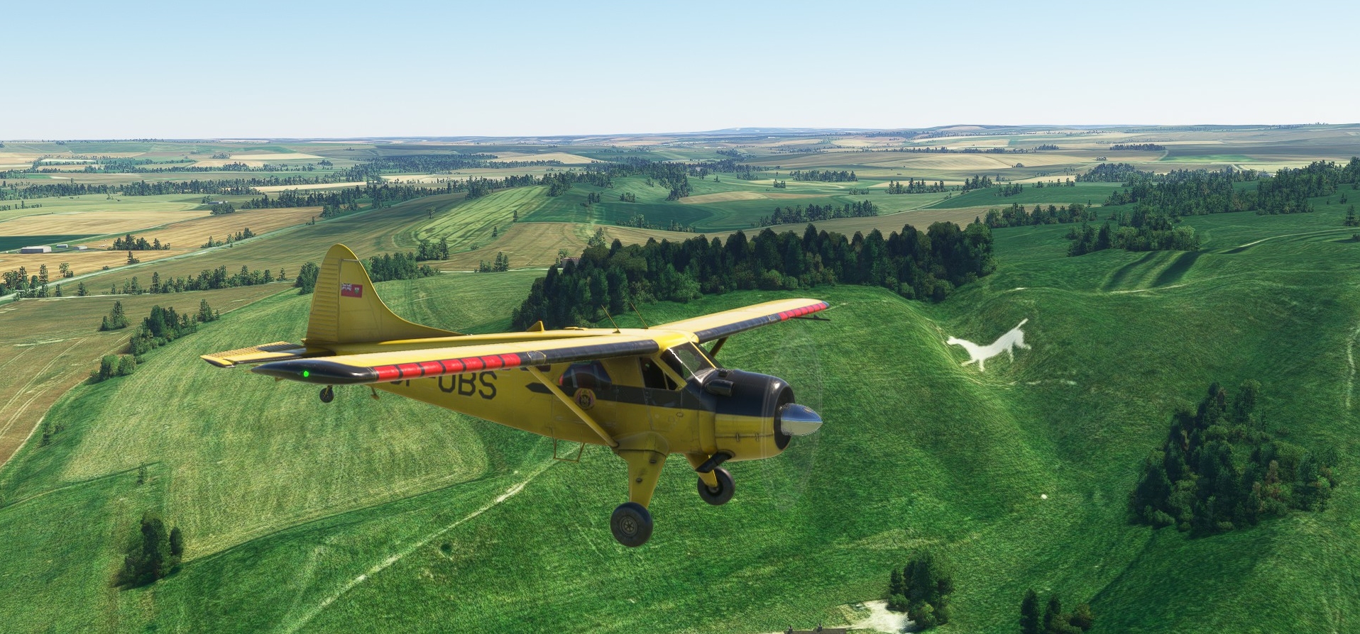
Coming to the chart-topper four years after its launch, I rather hoped to find online mod repositories heaving with add-on aircraft. Instead, the choice of free flyables seems pretty slim (Cornerites, if you have favourite freeware mounts, please recommend them in the comments) hence the selection of a default machine for today’s trip. I picked the Beaver because it has historical links to this part of the world (The DHC-2 operated out of Army Air Corps aerodromes in Wiltshire during the Sixties, Seventies, and Eighties) and a high wing and low stall speed means it’s well suited to aerial sightseeing.
Everyone strapped in and comfortable? Great. Let’s get this show on the road, Roman!
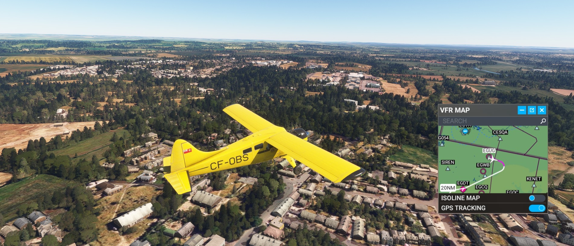
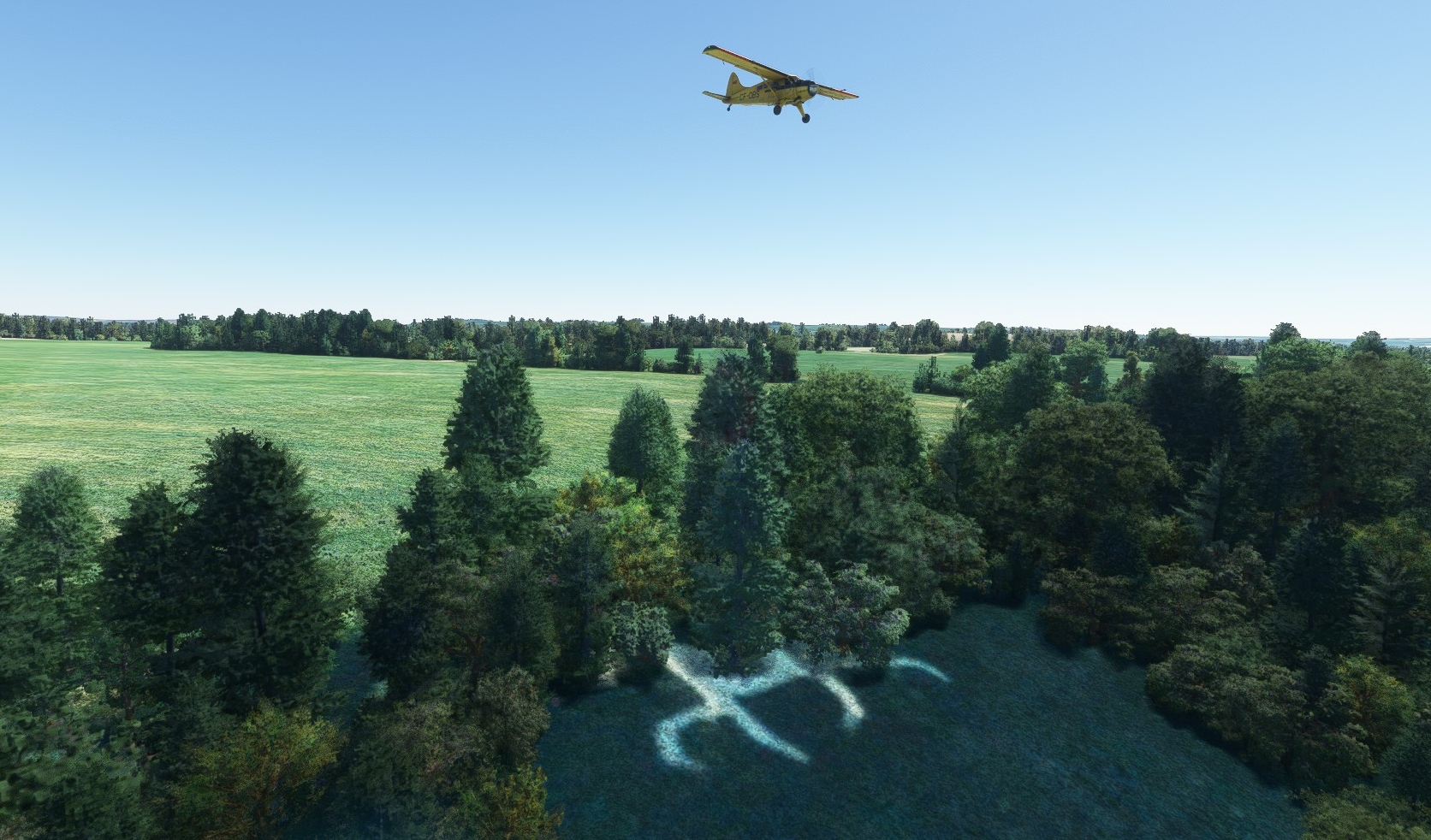
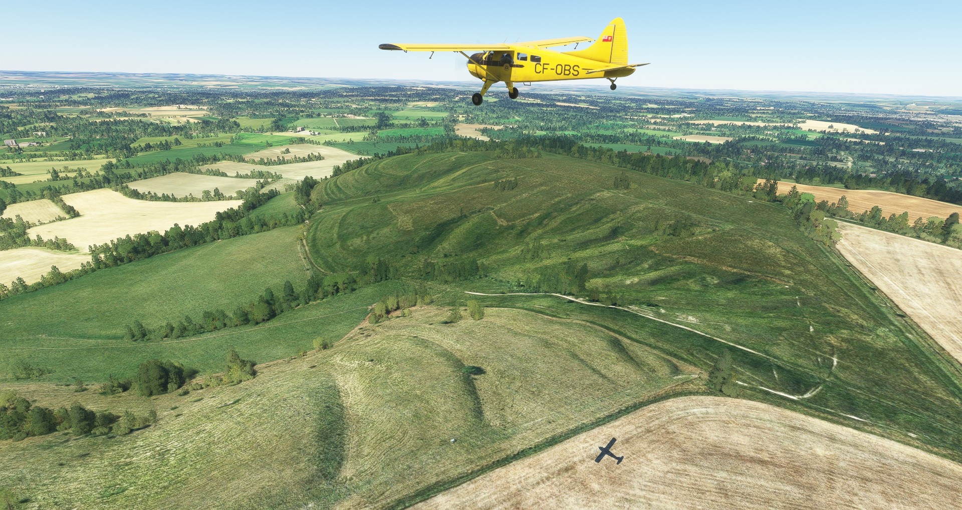
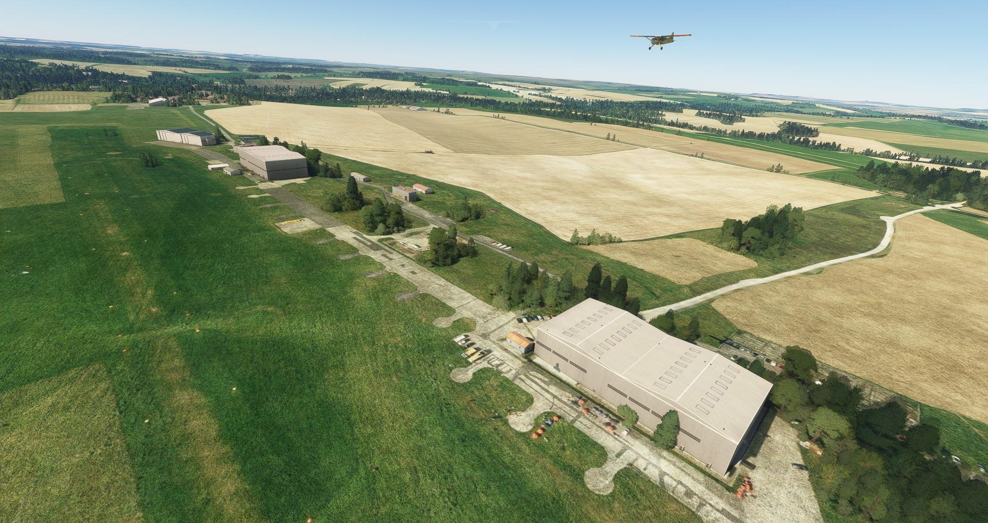
That herd of stampeding rooftops below is Shrivenham, the home of the UK’s Defence Academy and the birthplace of the Ministry of Defence’s Wargaming Handbook. Our ramble began at the village’s gliding hub – Sandhill Farm – because said strip is just five miles from the magnificent…
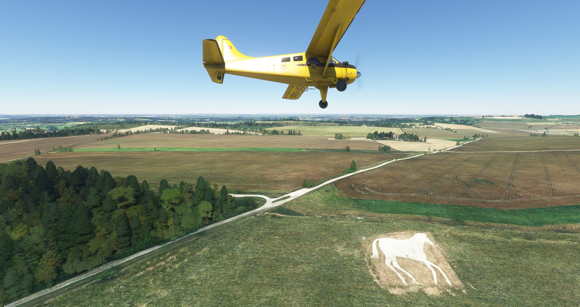
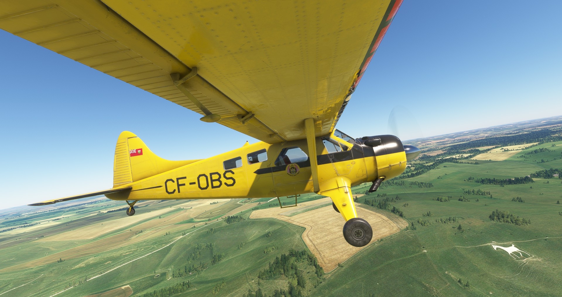
…Uffington White Horse. One hundred and ten metres long and positioned very close to a seriously ancient trackway, Britain’s oldest chalk hill figure was constructed during the Bronze Age. Why? Nobody knows for sure. The inhabitants of the adjacent hillfort may have been honouring a god or deceased bigwig, or commemorating a military victory. Perhaps it was simply their way of telling everyone in the vicinity that they were now mad-keen equestrians (horses were revolutionising warfare in England at the time).
Compared to the much younger white horses we’ll be visiting later, Uffington’s etched stallion oozes style and animation. Like many other chalk geoglyphs in SE England, it was hidden under turf during WW2 to prevent Luftwaffe navigators using it as a signpost. If anyone in the War Office ever suggested deepening the deception by constructing Starfish-style decoy figures elsewhere, the suggestion fell on deaf ears.
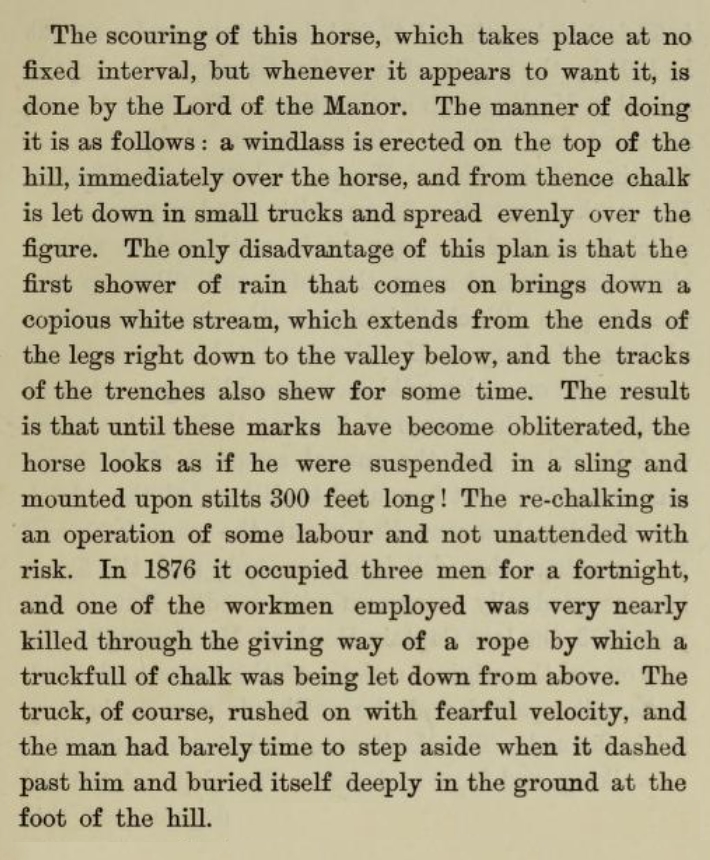
Talking of Starfish, that square of woodland up ahead hides the nerve-centre of mock Swindon. Judging from the bunker’s smooth environs, the diversionary fires lit here during the Blitz bamboozled few Boche bomb-aimers.
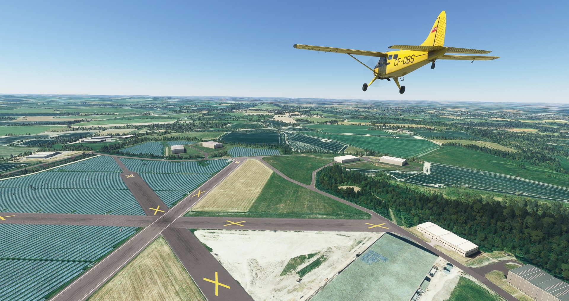
Solar-panel shrouded Wroughton airfield would be well worth a visit if the Science Museum Group’s Large Item Storage Facility was open to the public. Amongst other things lurking in those padlocked hangars and sheds down there is a Connie, a Comet, a Glasgow tram, and the world’s first practical hovercraft. Home of the ‘Eboladrome’, the test track used in the first few series of Top Gear follow-up The Grand Tour, Wroughton is a short hack from two Nineteenth Century white horses.
Bah. The closest of those gee-gees, Broad Town’s, although visible from miles around in real life, is largely hidden by autogen woodland in FS. Around 160 years old, the prototype was cut by a local landowner for unknown reasons.
Much more conspicuous in sim, nearby Broad Hinton’s horse dates to 1838 and was the village’s way of marking the coronation of Queen Victoria.
From Broad Hinton we will dawdle westward for a minute or two then follow the A3461 down to Avebury.
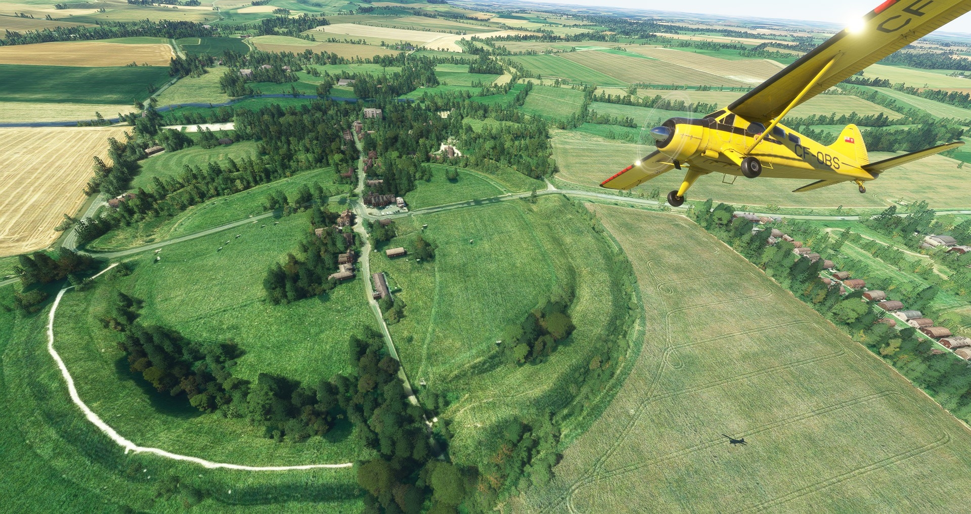
Situated seventeen miles from Wiltshire’s most famous tourist attraction, the largest stone circle in the world looked a lot more impressive before God-fearing locals began toppling and burying its pagan megaliths in the late Middle Ages. The Black Death temporarily halted the vandalism but another phase of destruction in the Seventeenth and Eighteenth Century – this time it was pragmatic housebuilders removing the standing stones – explains why the eastern side of the giant henge is as toothless as a Shakespearian crone today.
My pal, Roman, is somewhat obsessed by Avebury. In Upset, the work-in-progress horror novel he works on when he’s not composing foxers or chauffeuring Tally-Ho Corner tourists about, ghastly things start happening in the village after experimental archaeologists right one of the fallen Outer Circle sarsen stones.
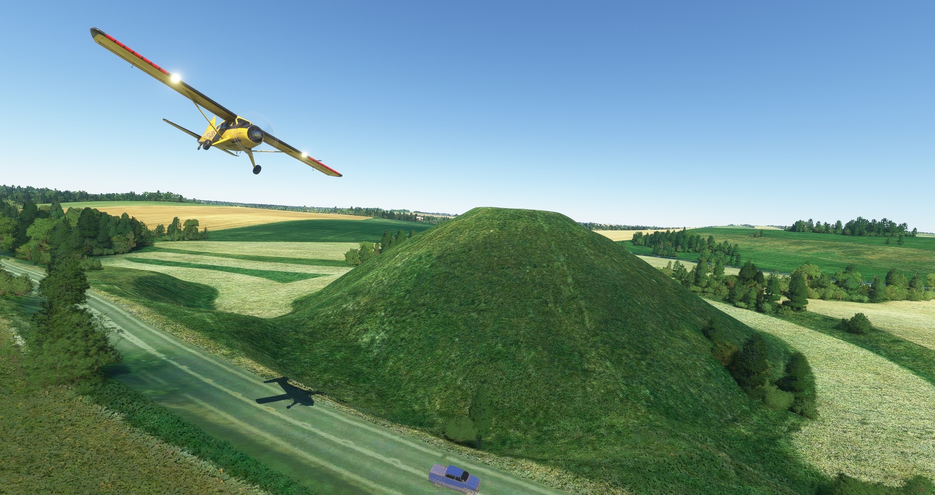
A menhir toss from Avebury and roughly contemporaneous with it, is Britain’s answer to the Great Pyramid of Giza. When constructed circa 2400BC, the forty-metre-high chalk and earth mound known today as Silbury Hill would have been a startling skull-white. Archaeologists reckon eighteen million man-hours – the equivalent of 150 people working full-time for fifteen years – went into its construction, and have put forward various theories as to its purpose. Me and Roman reject the fashionable notion that it was built for religious/ritual reasons. We prefer to think of it as the venue for a bizarre Stone Age team sport involving hazel staves, antler headdresses, live hedgehogs, and lots of shouting and tumbling.
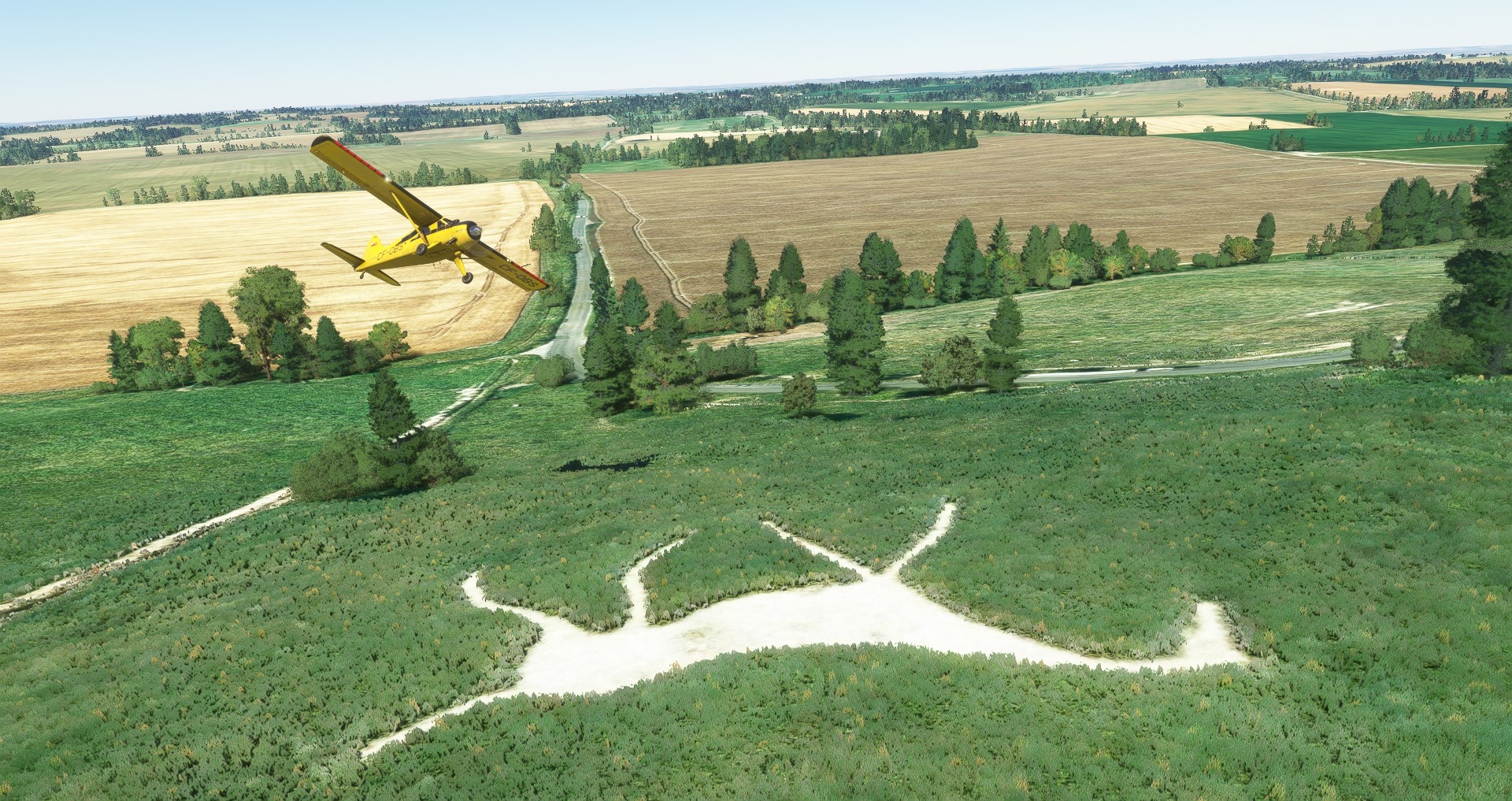
Time for another chalky nag, I think. Five kilometres west of Silbury Hill, there’s a rendition of Cherhill’s downland dobbin…
…somewhat marred by misaligned terrain mesh. Rather than paraphrase Wikipedia, I’ll let the inimitable Arthur Mee provide some background:
“One of the best of the Wiltshire horses, about 130 feet long, it was cut out on the slopes of this green ampitheatre in 1780. It was the idea of Dr Christopher Alsop, a Calne physician who stood a mile away and shouted his instructions through a trumpet to men who outlined the horse in flags. He stood on a hill called Labour-in-Vain, but little did he labour in vain, for his noble steed presides over as fair a scene as Wiltshire has.”
According to Victorian geoglyphile William Charles Plenderleath, for much of the Nineteenth Century the Cherhill horse sported a four-foot diameter glass eye made from buried bottles, and during one of its grooming sessions (all hill figures need to be maintained from time to time or Mother Nature eventually hides them from view) almost caused the death of a local labourer:
Here, in the stunning surroundings of Morgan’s Hill, I was hoping to show you a section of one of the UK’s most cruelly neglected historical wonders, Wansdyke. Sadly, FS2020’s mesh isn’t fine enough to properly reproduce the impressive ditch and bank of this trans-county early medieval defensive earthwork.
That snort of derision from my colleague was provoked by FS2020’s pitiful attempt to recreate semi-derelict farm buildings atop Roundway Down. While we’re both mightily impressed by the way Asobo’s creation blends Bing satellite images with 3D scenery, Blackshark.AI’s apparent inability to identify churches and farms has disappointed us.
If ‘Roundway Down’ sounds familiar, you’re either a resident of the nearby town of Devizes, or an English Civil War buff. Here in July 1643, in one of the biggest military upsets of the conflict, a Parliamentarian army roughly 5000 strong had its clock cleaned by a weary Royalist cavalry force less than half its size. Many a fleeing roundhead perished at the foot of this slope in an area known ever since as ‘Bloody Ditch’.
Carved into the south face of Roundway Down, the equine currently visible to port is a replacement for a one that overlooked Bloody Ditch from 1845 to about 1920. Constructed in 1999 to mark the Millennium, the new steed is of the same design as the vanished one, but is unique amongst Wiltshire’s wan whinniers in facing right.
Perhaps the Devizes beast is looking east because it has detected the scent of the next nag on our itinerary.
All of the hill figures in this part of the world are accustomed to the sight and sound of RAF and AAC helicopters, but, as far as I am aware, only two have ever been assisted by military whirlybirds. Described by Arthur Mee as a “high-stepping horse… cut out of the turf three years before Waterloo” the Alton Barnes horse was rechalked with help from a Chinook in 2019:
That’s glittering serpent to our right is the Hampshire/Salisbury Avon (Confusingly there are several River Avons in the UK).
We follow it southward, crossing two of the RFC’s very first airfields – Upavon and Netheravon – before peeling eastward to inspect Bulford’s decidedly exotic turf tattoo.
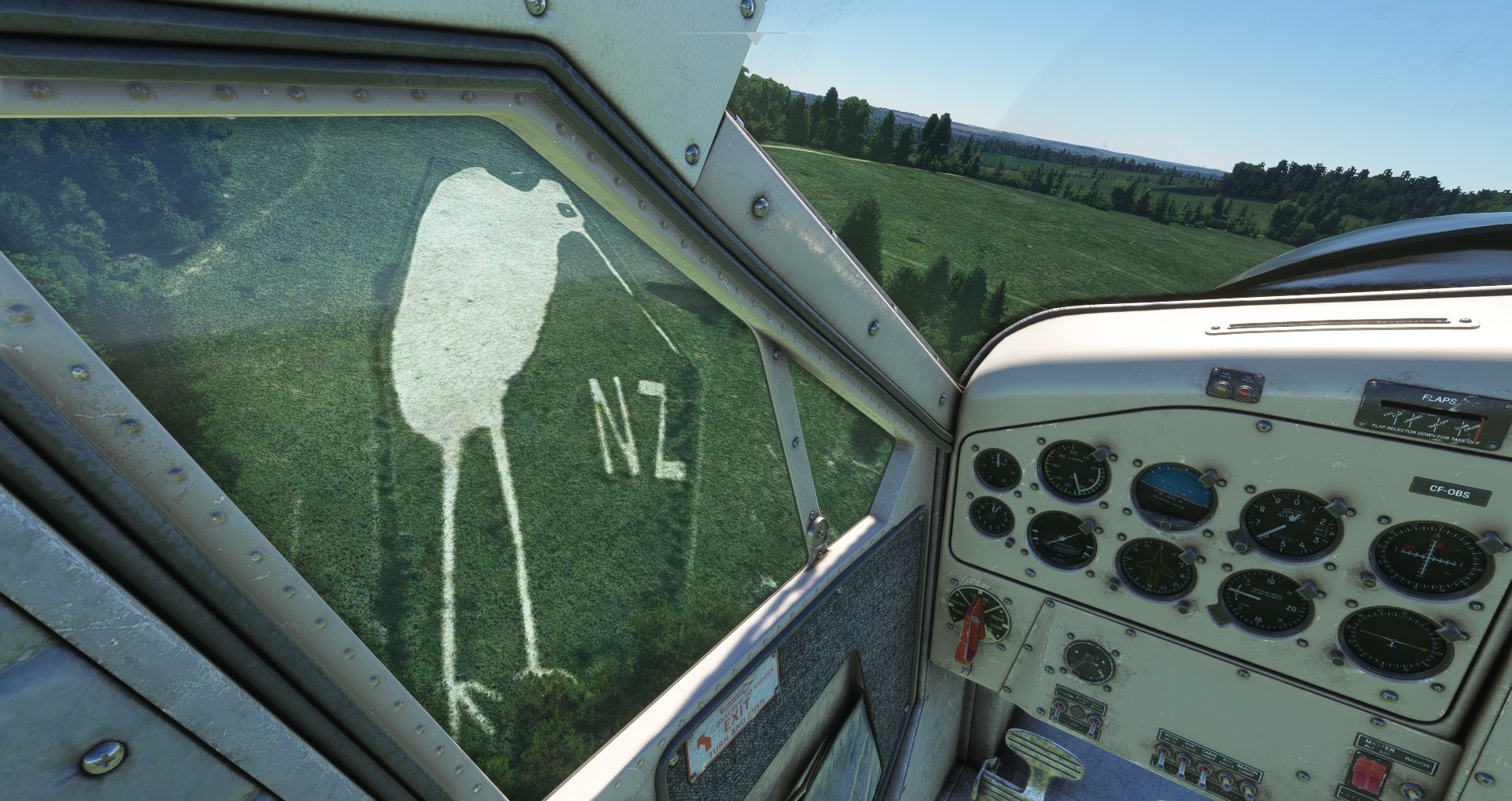
Conceived by commanders alarmed at the growing disaffection amongst NZ troops awaiting repatriation after WW1, the Bulford Kiwi appeared in Spring 1919. Much closer to willing and able carers than any of the other figures on our tour, there’s little danger this vast war memorial will ever disappear beneath bramble and gorse.
Time for a break, methinks. In next week’s instalment of Chalked Up there’ll be more monumental militaria and massive mounts. If all goes to plan our beaver will have a close encounter with a humongous hard-on too.
(TO BE CONTINUED)
Wonderful entry, although I shudder at the thought of defiling a sim as fine as MSFS with the use of a *groan* mouse yoke!
As an American that’s only ever been to urban Blighty, it’s always impressed me how your rural (is this area considered rural?) areas remain so tidily circumscribed. To my eye there is very little sprawl or commercial-scale agriculture — just ostensibly charming villages and green fields. How is this done? Strict zoning/building rules? Is the state somehow involved in helping maintain a socioeconomic balance?
I haven’t been keeping up with MSFS — I assume this scenery includes the UK World Update?
Looking forward to the next one.
Morale +1. Thanks. Planning laws are pretty strict in UK, but most southern towns and cities are gradually (and not so gradually, in some cases) expanding. Rural England lost a lot of hedgerows in the second half of the 20th Century. Happily, topography discouraged field consolidation in some areas, and new laws eventually halted the devastation.
“I assume this scenery includes the UK World Update?”
I only realised last night that FS2020 doesn’t automatically install world updates! The UK update doesn’t seem to enhance scenery in spots like Avebury, but it should make some of next week’s screenshots more eye-catching.
National Hedgerow Week is 6-12th May.
Presumably to survey the grumble.
Also, Tim, and unrelatedly, any chance we’ll get your take on Manor Lords? I’m hoping the growing census that it’s less a city builder and more a feudalism sim will entice an impression.
Manor Lords has been added to the 3×3 list. Thanks for the tip.
Add-on required for optimal scenery observance…. https://orbxdirect.com/product/gbr-south-msfs
🙂
‘Review code’ requested.
Who do I complain to about lack of refreshments?
I thought I saw Roman surreptitiously stashing aboard some Lamelles de cheval jerky.
I was planning to break out the geographically-appropriate snacks and beverages when we reached Salisbury.
Excellent! Hoped you’d get along well with MSFS. Written with your usual eloquent style and thoroughly enjoyable a read for it.
I keep meaning to do something similar to this, but looking at WW1/WW11 battlefields. I understand there are a few places where even MSFS still shows the ground in accurate enough a level to show the devastation. If you haven’t discovered it yet, https://flightsim.to/ is a pretty good starting place for freebies of all kinds – might even find some of the locations you’re visiting have been improved though I’ve not checked.
Thanks. An FS2020 air tour of the Zone Rouge is very tempting.
Of all the remnants of ancient times the Uffington White Horse remains by far my favourite.
It has artistic simplicity and style that matches anything contemporary, demonstrates a love and understanding of horses and it was created millennia before anybody could fully appreciate its elegance from the air.
Sir pTerry summed it up well: It captures the essence of horse.
From the ground it’s not easy to see, but it is easy to access and my American friend still talks about when I took her to see it. But yes, I’ll pop over in MSFS too!
All those other white horses? I knew there were several, didn’t realise so many are in Wiltshire.
More tantalising is part 2. Will Tim and Roman head South East for a famous henge or South West for a big man that you rather hope wouldn’t ride the horse. Either way, they’re heading in the general direction of perhaps the world’s finest tank museum. Plentiful history and options on offer, and I do look forward to finding out in due course.
“From the ground it’s not easy to see”
The weird positioning of the Uffington Horse (there are several slopes nearby that would have made better billboards) has caused some historians to postulate an astronomical explanation:
https://www.archaeology.org/issues/269-1709/from-the-trenches/5830-trenches-england-prehistoric-uffington-white-horse
Obviously, Roman subscribes to the ‘Giant dragon slain here’ hypothesis.
Is it just a neat story that the plethora of Avon rivers stems from the local´s word for river being `avon` at the time the Romans arrived in numbers? The type of misunderstanding sounds suspiciously similar to the origin story of the name of the Yucatan peninsula, so I remain sceptic.
As an aside: I can´t shake the feeling that Labour-in-Vain is some very, very specific in-joke not accessible to us average Joes living on the continent. (who, as far as I am concerned, want to part of it)
Jokes by Brits for Brits aside, I ruthlessly stole the Nazca lines for pen&paper roleplaying purposes and I am dead set on doing the same with the chalky horses. Thank you for reminding me of them.
*want no part of it*
No Sir, no part for me, please.
Ceterum censeo, 5 minute edit windows are a pain in the bum.
It seems to be generally accepted as fact, at least. And the word is still about – ‘river’ is ‘afon’ in Welsh and ‘abhainn’ (where bh is English v) in Scottish Gaelic.
There’s also an assortment of Rivers Esk, which is the same word as Gaelic ‘uisge’, water.
I’m never sure whether it’s lack of imagination or just complete insularity. It’s THE river, why would you need another one?
Thanks, ylla. I did not know it looks so similar in contemporary Welsh. I must admit, for many people on the continent, gaelic languages are more something of a theoretical concept. You lack even a basic, instinctive familiarity with them, since you are hardly exposed to them. Which is a shame, but that´s how it is.
Fascinating stuff Tim! I’m lucky enough to have seen all of them from the same perspective, and now I know a little more of their history!
It is almost impossible to head further south without putting in a slight detour to see the gentleman we’ll be meeting in part two – I don’t think I’ve ever been in the vicinity and not paid an aerial visit! For some reason navigators (we were the last aircraft to have pure navigators, and what an absolute pleasure they were to fly with) seem almost magnetically drawn to that particular pole.
Great read and long awaited! MSFS is so well-suited for sightseeing, but also suffers from this uncanny valley affect; it’s so believable so much of the time that it’s especially jarring when the cracks show through. Not a bad problem to have perhaps, but a problem nonetheless. I have to fight the urge to stay above 500′ in order to avoid disappointment.
A lot of the payware landmarks do help with this (and there are many decent freeware ones out there too). I find myself reluctant to purchase what amount to be, in most cases, simply more accurately-textured polygons, but once in the sim I generally don’t regret it. MSFS has actually done a pretty fair job of improving itself scenery-wise over the years, both with bespoke landmark updates as well as generally improving their AI-based scenery generation.
It makes for a great airplane museum as well. Having recently been on your side of the pond for a visit to Duxford, I’m tempted to get myself a copy of the recently released payware Avro Vulcan.